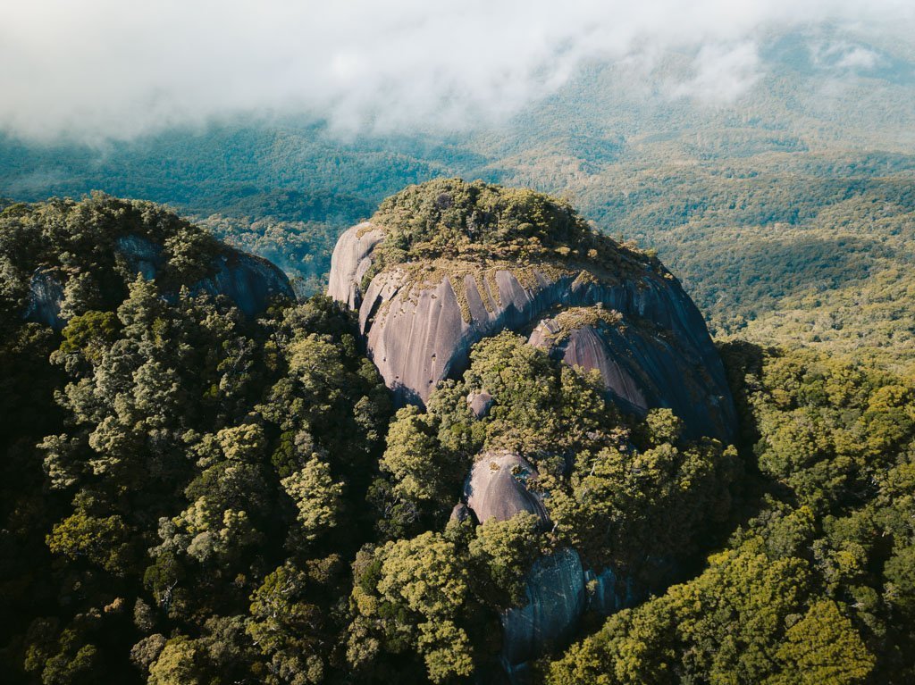
The Kahlpahlim Rock Hike, also known as Lamb’s Head, is a hiking trail located near the town of Mareeba, Queensland, approximately an hour from Cairns in Far North Queensland.
This is an enjoyable hike that can be attempted year-round and leads through both dense pine forest and thick, tropical rainforests.
At the summit, hikers can enjoy expansive views of Cairns and the Atherton Tablelands. If you’re in for a solid half-day hike to one of the best views near Cairns, then definitely give this one a go.
After hiking my way up to Kahlpahlim Rock, I’ve created this useful hiking guide based on my experience hiking in Cairns. I’ll include detailed directions, tips for the walk, and some of my photos that I hope will inspire your adventure to the summit!
Where is Kahlpahlim Rock
The Kahlpahlim Rock hike is located in the Dinden / Davies Creek National Park, near the town of Mareeba, approximately 1 hour from Cairns. Expect a longer drive during peak hours (7-9 am and 5-6 pm) when leaving Cairns.
Although it looks a lot closer to Cairns on the map, you'll need to drive around the National Parks and towards the Atherton Tablelands to get access to the trailhead.
Below is a map showing the route to the trailhead.

How To Get to the Lamb's Head Trailhead
There are no guided tours or companies that I know of that organise trips to the Kahlpahlim Rock hike. This means that the best way to get here is to drive to the trailhead yourself.
As mentioned, it will take just about 1 hour and 15 minutes to reach the trailhead from Cairns. Begin by heading up the winding Kennedy Highway, past Barron Falls and Kuranda. From Kuranda, continue for another 25 minutes on the same highway until you reach Davies Creek Road on the left.
This road leads to Davies Creek Falls, which is a worthwhile stop to cool off after the hike. Continue past the waterfall and the several designated camping sites (past site 6) until you see a small car park with a worn signpost indicating the start of the Ridge Track.
I've pinned the exact location of this car park on the map above.
You can either leave your car here and start on the Ridge Track as I did, or continue driving for another 5 minutes down Davies Creek Road until you reach the small car park for the Kahlpahlim Rock walking trail.

Guide to the Kahlpahlim Rock Walking Trail
Like the Mt Bartle Frere hike, the Kahlpahlim Rock hike is my favorite hikes near Cairns. You'll get to experience changing terrain as well as one of the greatest views of Cairns and the Atherton Tablelands you can find.
- Circuit Distance: 18 km return loop. This took just over 4 hours to complete at a moderate pace.
- Hike Elevation: 860 m elevation gain (1280 m AMLS at the ridge summit)
- Hike Difficulty: This track is commonly rated as hard. However, if you have a decent level of fitness, you won't have any trouble completing the hike up to Kahlpahlim Rock. It's not any harder than the Walsh's Pyramid Hike.
The track is well-marked by orange arrows and ribbons on trees. Since it's a little out of the way, you'll also probably have the whole track to yourself.

Related: Devils Thumb Hike (Manjal Jimalji)
My Experience Hiking the Kahlpahlim Rock Trail
The Kahlpahlim Rock Trail is a longer, wider shoot for the ridge that begins at the very end of Davies Creek Road. The track starts through tropical flora and climbs steeply on an old pine-dotted logging trail, over a rocky outcrop and ends with an ascent through thick, wet tropical rainforest.

Both trails meet up at a plateauing rocky section which had signs of backburning or fire when I completed the hike. From here, it's a wet, steep ascent to the foot of the huge Kahlpahlim Rock. From here, the trail turns left along the rocky wall, down the wet slopes and finally dog-legs sharply up to the ridge.
Once you gain the ridge, you can choose to walk right to reach the rock or left for the research station.


The Ridge Trail
The Ridge Trail also begins on a flat gradient, which quickly steepens once you reach a section of thick pine forest. After a steep and rapid ascent, you'll reach the rocky outcrop where the two trails join up.
It's said that the Ridge Trail is steeper than the Kahlpahlim Rock trail, which is why some recommend starting with the latter and descending on the Ridge Trail.
However, I found the Ridge Trail to be a comfortable climb. If you're short on time and want to smash it out, you can also come up and down on the Ridge Trail, since the total distance will be shorter.

Also Nearby: Turtle Rock Hike
Kahlpahlim Rock (Lambs Head) Summit and View
At the top of the Kahlpahlim Rock hike, the best views of Cairns and adjacent rainforest can be found by climbing the rocky clearing to the right as you gain the ridge.
You can also walk left here, following the orange markers to a clearing with a large research station. If you follow the trail markers further into the adjacent bush, you'll also be lead out to a steep grassy clearing with great views out towards the Atherton Tablelands.
Below you'll find some shots I took from the ridge and with my drone.


Hiking the Return Loop
The Kahlpahlim Rock hike is best completed in a circuit loop. Both trails lead to the Lamb's Head Rock, so you can choose which track you want to start with.
I decided to make the ascent on the steeper Ridge Trail and come back down on the wider stretching Kahlpahlim Rock track.
Note that the car park locations for these track trailheads are in separate locations down Davies Creek Road, so if you walk the circuit loop, there'll be a final 20-minute section of road walking.

Kahlpahlim Rock Map
Here's the official Queensland Parks Kahlpahlim Rock Map that you can download or print. Note both tracks are included and meet up at a rocky section before the final ascent to the ridge.

Kahlpahlim Rock Hike GPX Map
Below is the Kahlpahlim Rock GPX route that I took. You can download this using the link below and use it on your phone or GPS watch to help you navigate. However, don't rely on it as a primary means of navigation.
GPX File: Download
My Strava Activity: Visit
Related: Red Arrow, Blue Arrow Tracks Cairns
Where to Stay In Cairns
Visiting Cairns? The best places to stay are near the Cairns Esplanade or on the sunny Northern Beaches. Below are the top 4 options for varying budgets.
Alternatively, check out my Port Douglas accommodation guide for more ideas on where to stay in Far North Queensland.

1. Crystalbrook Riley Luxury
If luxury and location are what you're after, you can't beat this 5-star resort right in the heart of Cairns Esplanade.

2. Fitzroy Island Resort Mid-Range
Sleep out on one of the picturesque Great Barrier Reef Islands! Staying at Fitzroy often works out cheaper than staying in town & means you get more time to explore the reef, beaches, and rainforest walking trails.

3. Gilligan's Backpackers Budget
The best backpacker option for a great vibe in Cairns. Great place to meet like-minded travelers & features a pool, air-con rooms, a huge shared kitchen, & a great common area.

4. Pepper's Beach Club Palm Cove
Stay at the best beach resort in the heart of Palm Cove on Cairns's Northern Beaches!
FAQs About Hiking to Kahlpahlim Rock
What is the best time of year to hike to Kahlpahlim Rock?
The ideal time to hike Kahlpahlim Rock is during the cooler months from April to September. The weather is more favorable, with lower humidity and temperatures, making the hike more enjoyable.
How difficult is the Kahlpahlim Rock hike?
It's a fairly challenging hike, especially if you're not used to hiking in the QLD tropics. A good level of fitness and experience in bushwalking or hiking is recommended. However, I'd say it's no harder than Walsh's Pyramid from my experience.
What should I bring on my hike up to Kahlpahlim Rock?
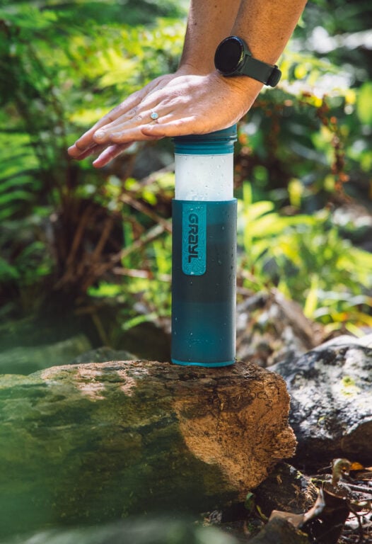
Essential items include at least 3 liters of water per person, high-energy snacks, a first aid kit, a map, and a compass or GPS device. Don't forget sun protection and insect repellent to void off the ticks and leeches, especially in the wet season!
More Epic Cairns Hikes and Adventures
I hope you found this Kahlpahlim Rock Hike guide useful. If you have any questions, or if you want to reach out, don't forget to leave a comment.
If you're up for more Far North Queensland adventures, check out some of the other detailed guides below!
- 60+ Things to do in Cairns - my ultimate Cairns and FNQ travel resource covering the best activities, hidden gems, and unmissable experiences.
- Cairns Hiking Guide - a huge list of epic rainforest, waterfall, and lookout hikes in Cairns.
- Cairns Waterfalls - a huge list of epic waterfalls that I've visited in Cairns and the surrounding tropics.
- Cairns Islands - discover my favorite Great Barrier Reef islands near Cairns and Port Douglas.
- Cairns Tours - my roundup of the best tours you can book in Cairns and FNQ, from the Great Barrier Reef to the Daintree Rainforest.
- Cairns Packing List - tips on what to pack for a trip to Far North Queensland.
- Top Things to Do in Port Douglas - a comprehensive guide to the sleepy Far North Queensland town of Port Douglas.
- Epic 5-Day Cairns Itinerary - my suggested adventure itinerary if you only have 5 days to spend in Cairns.
- Cape Tribulation Travel Guide - discover where the rainforest meets the reef at one of my favourite places in Australia.
- Best Things to do in the Atherton Tablelands - my guide to one of Far North Queensland's most underrated adventure destinations.
- Accommodation Resources: Discover where to stay in Cairns, the best hotels in Port Douglas and my Cape Tribulation accommodation guide.


