Trekking to K2 Base Camp provides one of the most raw, rugged, and epic adventures you can find anywhere on the planet.
The journey follows the Baltoro Glacier in the Karakoram region of Northern Pakistan. You’ll pass beneath a range with the highest concentration of massive mountains on earth, including 18 peaks above 7,500 m (24,600 ft) and four peaks over 8,000 meters. The goal is to reach the base camp of the second-highest mountain in the world; K2 (Karakoram 2, or Savage Mountain) towering 8,611 meters above sea level.
I trekked the Epic Expeditions K2 Base Camp itinerary starting from Islamabad > Skardu > Askole, and returned via the Gondogoro La Pass (5,585 m). Below I will share my full day-by-day trekking itinerary, with photos, things I learned, and a quick guide to help you prepare for your trek.

K2 Base Camp Trek Overview
Here's what you need to know about reaching the base camp of the world's second-highest peak.
- Location: The K2 Base Camp Trek is located in the remote Karakoram Mountain Range in Northern Pakistan, within Central Karakoram National Park. This region is near the sensitive borders of India and China.
- Distance & Duration: Approximately 160 km (99 miles) & typically involves 12-14 days of trekking (an additional 4 days minimum for transport necessary).
- Elevation: The highest point is Gondogoro Pass at 5,585 meters (18,323 feet). Total elevation gain of around 10,000 meters (32,808 feet), including undulating glacial walking and some steep ascents/descents.
- Campsites: Comparing the K2 Trek to the Everest BC trek, accommodations are in tents, not tea houses. Each night, you’ll camp at scenic sites with epic views of 7,000 and 8,000-meter peaks.
- Physical Requirements: Prepare for 6-10 hours of hiking daily, handling altitudes above 5,000 meters, and navigating rocky glacier terrain. A good acclimatization profile was built into our trekking itinerary with Epic, with seven days allocated to reach base camp
- Difficulty: Physically demanding but not technically difficult. The trek is much more challenging than the Everest Base Camp Trek due to its length, steepness, and rugged rocky, glacial terrain. Crossing the Gondogoro La is the most demanding day, involving fixed ropes and steep sections over 8-12 hours.
- Weather Conditions: Be prepared for extremely varying weather, ranging from hot, intense sun to rain, & whiteout snowstorms. Read my K2 Base Camp packing list for essential gear.
- Permit & Guide Requirements: A guide and permits are mandatory. You must book with a registered tour operator who will organize permits. I recommend Epic Expeditions for their quality guides, tents, and kitchen staff (use code OLLY5 for 5% discount).
- Insurance: Unlike Nepal, rescue & helicopter evacuation services are very limited, and runs through the Pakistani military at $20,000 USD per rescue. Therefore high altitude trekking insurance is essential. I use and recommend Global Rescue membership for no altitude cap rescues.
Popularity: While growing in popularity the K2 Base Camp trek still sees only around 4,000 visitors annually– offering an off-the-beaten-path adventure to one of the most remote and dramatic regions on earth, without the EBC crowds.

My Recommended Trekking Company in Pakistan
I booked this trip with Epic Expeditions, one of the original and best companies offering trips to K2 Base Camp. This was my second trip with Epic after a great experience climbing Island Peak with them the year prior.
At $4,150 the trip is slightly more expensive than some other options but includes all costs such as internal flights, transfers, accommodation, food, drinks, permits, etc. This is also a 21-day itinerary with 14 days of trekking, allowing for flights, (frequent) domestic travel delays, and weather contingencies to maximize your chances of crossing the Gondogoro La.
Important: This is not Nepal or Tanzania. I highly recommend choosing a reputable company in Pakistan as the trekking industry is much more primitive and the region very remote. We encountered a trekking group that ran out of food and others that skipped Gondogoro La to cut costs, forcing the clients to descend the entire Baltoro Glacier instead.
Discount: Get 5% off the entire cost of the trip with Epic Expeditions using code OLLY5.


Day-By-Day Itinerary Trekking to K2 Base Camp
Below is a detailed trekking itinerary I wrote nightly in my tent summing up exactly what to expect on each day of the trek.
This K2 itinerary begins with a flight from Islamabad to Skardu. However, I flew into Islamabad the day before the trip and stayed at the recommended hotel for $50 per night. The official first day of the trip is in Islamabad, but this day is used for briefings, gear checks, and meeting our trekking mates, so I've left it out.
Tip: Hike distances and duration can vary by season. This is due to the ever-shifting nature of the Boltoro Glacier. As you'll see below, actual itineraries usually change slightly as well to accommodate rest days, stomach problems, weather, and delays.

Day 1: Flight to Skardu
The K2 Base Camp Trek begins with a short but incredibly scenic 50-minute flight from Islamabad to the northern city of Skardu. At 2,228 m, Skardu is the largest city in Baltistan and is situated in a wide valley surrounded by towering peaks on all sides.
The flight into Skardu is one of the most scenic I’ve ever experienced, passing close by Nanga Parbat (8,126 m) on the right side of the plane before descending into a moon-like glacial valley.

Stepping off the plane, we took some time to admire the incredible views from the runway before getting transferred to our hotel above the town, where we spent most of the afternoon relaxing and getting to know our group mates over some great meals.
Tip: for incredible plane views of Nanga Parbat and other high peaks, ask for window seats on the right side of the plane. Sohail, our guide from Epic got us in early at check-in for great seats which I was thankful for.

Day 2: Preparations in Skardu
The following day is a rest day in Skardu. This has many benefits, including the allowance of extra contingency time due to potential flight cancellations, or in the worst-case scenario, enough time to take the long drive from Islamabad.
Secondly, another rest day in Skardu helps ease trekkers into the higher altitude.
There’s plenty to do in Skardu but we chose to take the 6 km hike to Satpara Lake, a beautiful turquoise dam on the road to Deosai National Park.
In the afternoon, we relaxed and enjoyed the last day of relative comfort, preparing for the long jeep journey the following day.


Day 3: Jeep Drive from Skardu to Askole
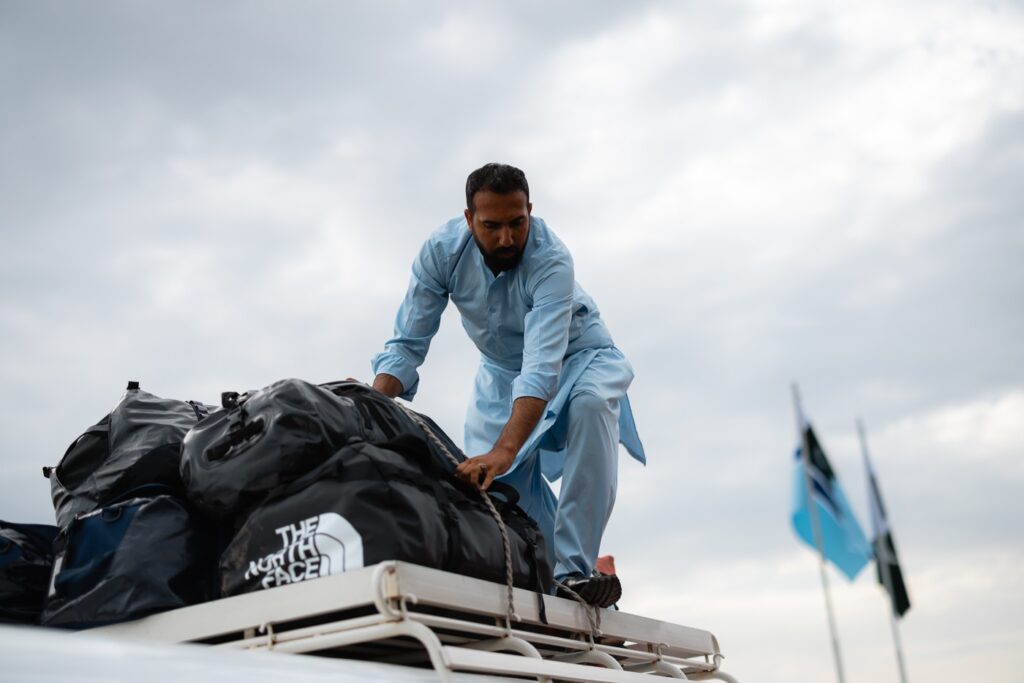
The drive from Skardu to Askole began at 5 in the morning after loading our duffels into the colorful land cruisers sporting Cadillac badges. While the drive only takes 6 hours including a breakfast stop, an early departure reduces the chance of oncoming traffic on the notoriously narrow roads.

The drive itself is an adventure along a thin strip of road carved into the high banks of the Bradly River. getting increasingly more nail-biting as the day goes on. Expect sharp corners, bumpy terrain, and sections of “road” that are barely just hanging on.
Eventually, we arrived in Pakistan’s northernmost village, Askole, where we’d finally meet our kitchen staff just in time for lunch.


After exploring the town and two local teens showing us their "Askole Museum", we shared a meal with the group in the mess tent for the first time. This was also the first night spent in the tents.


Day 4: Askole to Jhula Camp (3,150 m)
- Hike Distance: 17.7 km
- Duration: 6 hours
- Elevation: 350 m
After a few long days of anticipation, it was finally time to lace up the boots and hit the trail.
The first part of the K2 Base Camp Trek departs Askole toward a check-in hut and entrance to the Karakoram National Park. We were greeted by a park officer who gave us a quick briefing, asked us to sign a piece of paper, and set us on our way.


The first day is very hot and exposed to the sun for the entire day. There is only one shaded area after approximately 12 kilometers where we stopped for lunch.
Trekking on the first day is long but it is quite flat for the majority of the trek, except for a slightly steep final section before reaching Jhula Camp (3,150 m). The views are quite phenomenal, with countless unnamed 6,000-meter mountains and a few 7,000-meter peaks visible.


There is a new bridge constructed near the camp, which saves about 4 kilometers of trekking. Since the shaded Jhula Camp was filled with, we decided to camp on the sandy river banks.
Tip: Some K2 Base Camp trekking itineraries will start with a Jeep drive to Jhula Camp. However, this section is now off-limits for vehicles, with all trekkers now starting trekking from Askole.


Day 5: Jhula Camp to Paju Camp (3,383 m)
- Hike Distance: 19 km
- Duration: 7-8 hours
- Elevation: 600 m
The second day of trekking to K2 Base Camp is yet another hot and dusty day following the western bank of the Braldu River.
For me, this day was more difficult than the first and involved several sections of undulating terrain and a few small creek crossings.


After approximately 15 km of trekking, we laid eyes on Paju Camp (3,383 m) a green-sloping section carpeted against the orange rock. While it looked close, we still had 4 km to go from this point, which was also the most demanding part of the day.


The final section involves a steep climb, before dropping back down to the river bank and walking along a thin strip of sand between the river and the mountain.
Eventually, the day ends at Paju Camp. This is a pleasant, shaded camp with plenty of space. Our team from Epic Expeditions sent a porter out at 3:30 in the morning to secure us an excellent campsite that offered welcome relief from the blistering sun.
Note: Unfortunately a member of our team was struggling with stomach issues which resulted in us using a contingency day to rest at Paju Camp on day 6. This highlights the importance of allowing extra days on the K2 Base Camp itinerary. For the purpose of this post, I’ll continue below as day 6.


Day 6: Paju Camp to Khoburtse Camp (3,820 m)
- Hike Distance: 13.7 km
- Duration: 6-8 hours
- Elevation: 695 m
Departing Paju Camp, the trail drops down to the valley floor, reaching the mouth of the Boltoro Glacier after approximately an hour.
The Boltoro Glacier will now be our home for the next few days as we make our way to Concordia and eventually K2 Base Camp. The glacier is covered with a thick layer of rocky debris, which makes the first 10 km quite demanding, with steep undulation on uneven terrain.


The route makes its way up the glacier before crossing to the eastern side. Along the way, we stopped to admire our first views of the famous Trango Towers.


Soon, the trail evens out and climbs gently along Boltoro’s eastern moraine. Be careful on this section as it is steep and rock slides are frequent.

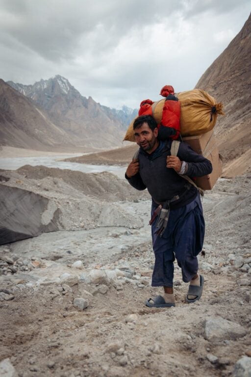
Eventually, we reached Khoburtse Camp (3,820 m), a small camp squeezed onto the edge of the glacier beside a modest waterfall. The camp is quite small meaning limited space for tents.
However, there is a nice flowing stream of water which we took advantage of for a cool shower in the hot sun. We also got excellent views of Paiju Peak (6,610 m) and Choricho (6,789 m) from our tents.


Day 7: Khoburtse Camp to Urdukas (4,050 m)
- Hike Distance: 6 km
- Duration: 2.5-3.5 hours
- Elevation: 350 m
The trek to Urdukas is a relatively short day which begins with a gentle climb on the edge of the moraine before entering back onto the Boltoro Glacier.


This is the first time of the trek so far that we actually walked on ice, with amazing views of glacial valleys pouring into the Boltoro on each side. In the distance, we spotted Broad Peak (8,051 m) and Gasherbrum IV (7,932 m) for the first time.


This trek was not very difficult but had some steep undulating sections before finally arriving at Urdukas, one of the most beautiful campsites in the world.


From the tents, we had direct views of the Trango Towers and Lobsang Spire. In the evening, we even spotted the headlamps of climbers ascending the Great Trango Tower which was incredible.


Day 8: Urdukas to Goro 2 (4,250 m)
- Hike Distance: 11.4 km
- Duration: 6-7 hours
- Elevation: 470 m
The morning starts with a short 30-minute section on the moraine before reentering the glacier. The first part of the day is an endless maze covering a path of undulating rock and ice through the Boltoro.
Along the way, we spotted many blue pools and beautiful ice caves, sharing the trail with mules and porters.


Roughly halfway is the Goro 1 campsite which is a good spot for lunch. The last stretch evens out to a wide path that is much easier to traverse.
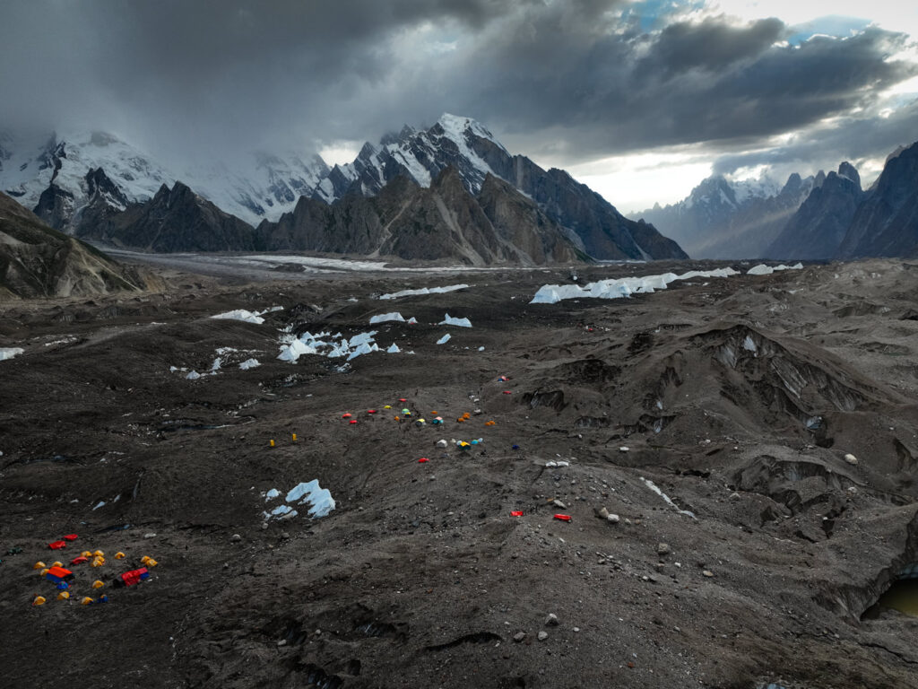
Goro 2 campsite is the first night where we slept on the glacier. The site is a wide expanse of ice and rock offering incredible views of Gasherbrum IV down the valley, as well as Masherbrum (7,821 m) also known as K1 to the southwest and the top of Broad Peak to the northeast.


I noticed that the temperatures were much colder in the night at this campsite, since the tents were pitched on ice.



Day 9: Goro 2 to Concordia (4,600 m)
- Hike Distance: 13.5 km
- Duration: 6-7 hours
- Elevation: 520 m
After an early wake-up to catch the sunrise glow on Masherbrum, we set off towards Concordia (4,600 m). The trail leads to the end of the Boltoro Glacier, with much easier terrain, similar to the second section on the day prior.
Along the route, we passed huge chunks of ice the size of small houses, with increasingly more majestic views of G4, Broad Peak, and Mitre Peak (6,030 m).


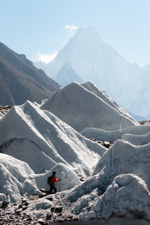

Finally, we arrived at Concordia, named the Throne Room of the Gods, and the crossroads where the Boltoro Glacier meets with the Godwin Austin Glacier.


This camp site is by far one of the most beautiful in the world, and we were treated to clear skies for sunset. This is also the first time we could see K2 (8,611 m) on the trek, along with other beautiful peaks including Angelus (6,802 m), Marble Peak (6,256 m), Mitre Peak, and Broad Peak.


Day 10: Concordia to K2 Base Camp (4,950 m) to Concordia
- Hike Distance: 23.7 km
- Duration: 10-12 hours
- Elevation: 580 m
All K2 Base Camp trekking itineraries will vary depending on the weather, group fitness, and the amount of rest days remaining. For us, there was an excellent weather window for the Gondogoro La in the coming days, and we’d already used up a rest day.
So, our group decided to trek to K2 Base Camp from Concordia and return the same day.

This is a very long walk, starting with an undulating maze through the confluence of the Godwin Austen and Boltoro Glaciers. This soon leveled out to a gradual yet rocky ascent up the glacier, with the mighty K2 getting taller as we approached.

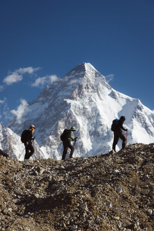

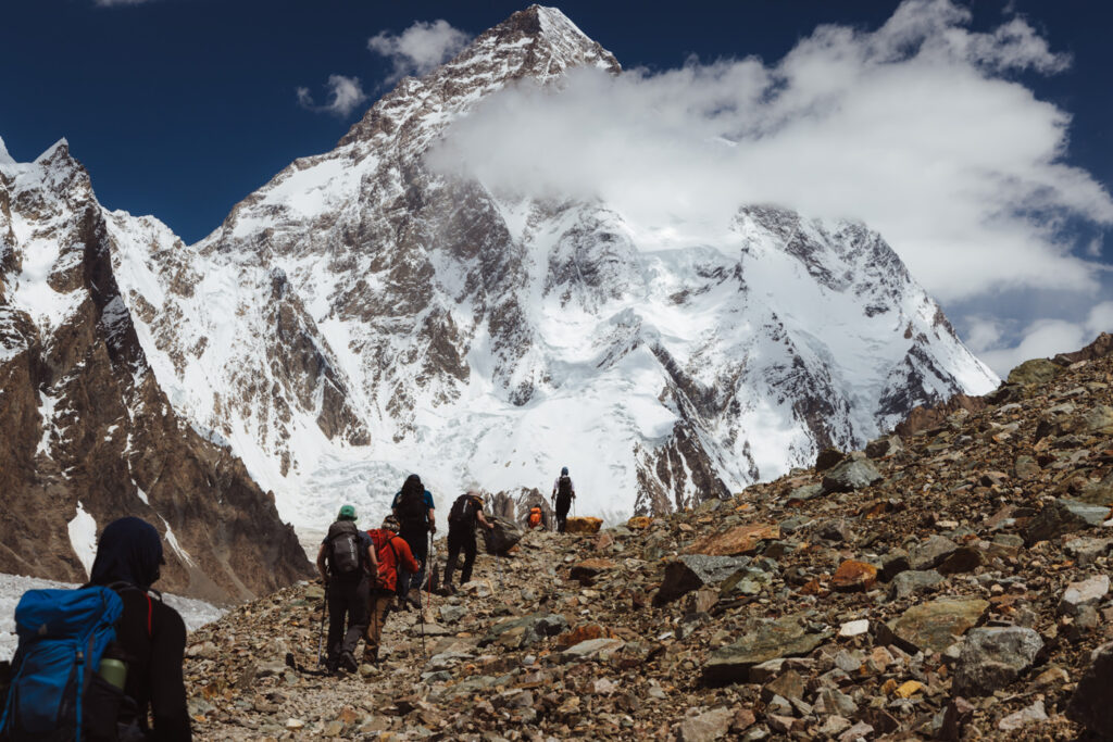

After approximately 4 hours we reached Broad Peak base camp, where we stopped for a tea and rest.
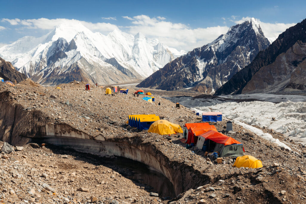
Next, we continued for approximately 2 hours more until we spotted K2 Base Camp.
We decided to visit the K2 memorial, climbing the steep rocky outcrop just west of camp. It was quite humbling to see the historic memorials commemorating the brave lives lost in this part of the Karakoram.
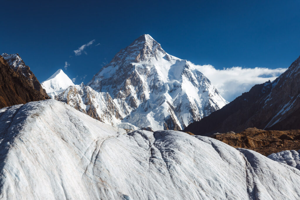

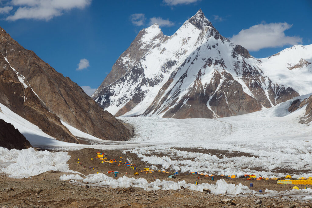


After our visit, we turned around and continued down the long descent to Concordia, walking on the soft ice rather than the rocks to quicken the pace.


Day 11: Rest Day in Concordia
Rather than staying at K2 Base Camp the day prior, we decided to continue down on the same day to get a full rest day in Concordia before the long push to Ali Camp and over the Gondogora La. For us, we were happy with this choice as Concordia is much more scenic than K2 Base Camp, especially with magnificent views of K2 (at base camp the peak is too close for good views or photos).
We spent the day relaxing in the Throne Room of the Gods, admiring the beautiful peaks all around us.


Unfortunately, we heard news of two Japanese climbers attempting a new route on K2 who had lost their lives that morning.
In the evening, we watched the lights of climbers making their way from camp 2 to camp 3, using my long telephoto lens to capture the climbers from Concordia.


Tip: Most trekkers use a Grayl GeoPress on the K2 trek to filter water. I recommend bringing a spare filter as the water on the Boltoro is very mineral-rich which can clog the filter, making it harder to press.


Day 12: Concordia to Ali Camp (4,950 m)
- Hike Distance: 10.5 km
- Duration: 4-5 hours
- Elevation: 430 m
After a peaceful and relaxing rest day with glorious weather, we were again ready to hit the trail towards the Gondogoro La.
Most K2 Base Camp trekking itineraries will return to Askole via the same way we hiked in on the Boltoro Glacier. However, the trip with Epic (and a select few others) will cross this pass.
We left some unnecessary gear with the mule porters in Concordia, who would bring it back to us in Skardu. This is because mules cannot continue onto the next section toward the pass, and all gear must be carried by porters.


The first section follows the Boltoro Glacier for approximately 10.5 km to Ali Camp (4,950 m). The trail begins with steep undulating sections similar to the first section of the Goodwin Austen glacier toward K2 Base Camp. However this soon eased off as we left the rocks behind and began trekking on the soft ice of the glacier.
This continues in a gentle incline all the way to the rocky camp perched just above the glacier. Along the way we hopped over some blue streams and crevasses, with views of the Gashebrums behind us.

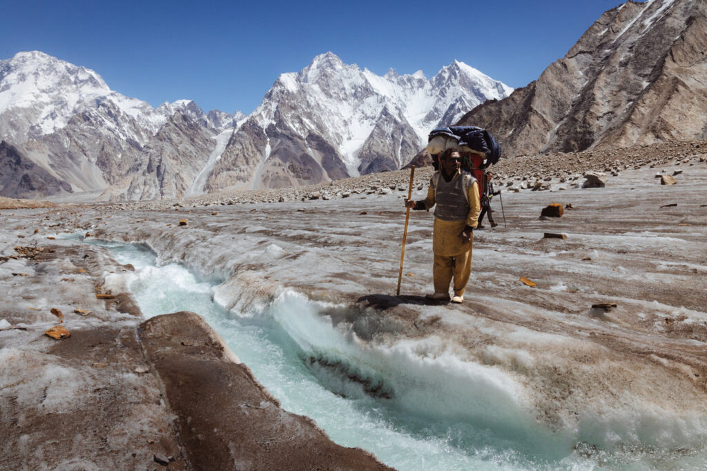

Ali Camp is a very basic camp with limited facilities since porters only bring the basics. However, our group were treated to a mess tent where we enjoyed some tea and a very early dinner before getting into our tents to prepare for the 11 pm alarm to cross the pass. Luckily, the sun sets behind the mountains early on, which meant relief from the hot sun.


Day 13: Ali Camp to Kuisbang (4,700 m) via the Gondogoro La (5,600 m)
- Hike Distance: 9.2 km
- Duration: 10-12 hours
- Elevation: 660 m
After a few hours of sleep, we woke up for a quick breakfast and were off toward the pass at 11:30 pm.
Leaving with headlamps and harnesses on, we began the rocky balancing act up the moraine beside Ali Camp and toward a snowy glacial bowl beneath Gondogoro La.

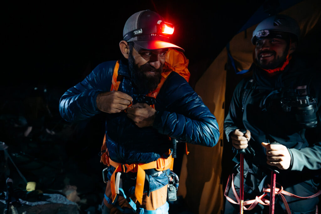
Soon, we walked down onto the Glacier, where we could see the pass lit up with a row of headlamps from other trekkers. Our guide Sohail walked us across the glacier, carefully following a series of flags in the dark to avoid crevasses and sections of thin ice.

At the base of the pass (the crampon point) we donned our crampons (I used microspikes) and helmets and began the steep ascent via the fixed ropes.


The way up to the pass begins with an increasingly steepening angle of ascent, maxing at around 50 degrees (it’s very steep). The way up doesn’t feel like a trek but also not a technical climb.


As we approached the last sections, we looked back to see all the largest peaks in the area lit up by a beautiful rising sun.


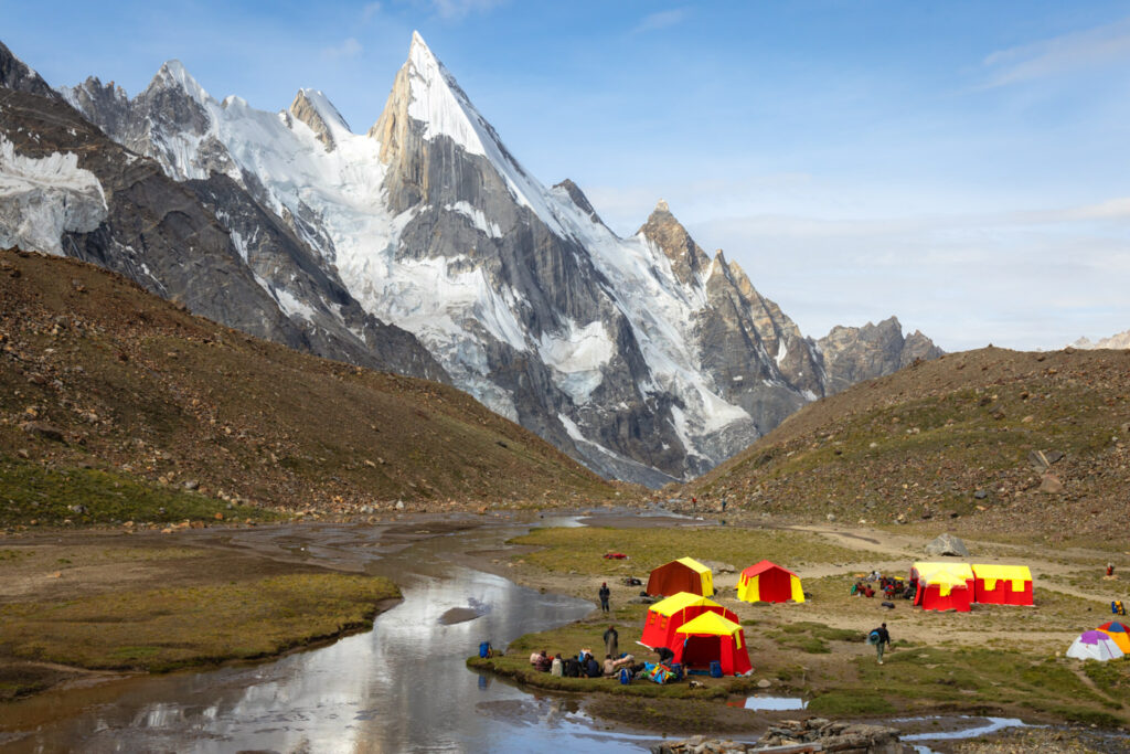
We reached the top of Gondogoro La just in time to see the other side lit up by the same sun, and witnessed the impressive sight of Laila Peak for the first time.


After a few cold minutes taking photos, we began the long descent.
The descent from the Gondogoro La is very long and steep. There are fixed ropes nearly all the way down, which we clipped into with carabiners for safety.


I would suggest not to underestimate the descent, while not technical, it is much steeper than the ascent, with a mix of snow, rock, and scree.


It took us several slippery hours to descend to the Gondogoro Glacier below, followed by a 4 km undulating yet increasingly green hike to Kuisbang (4,700 m).

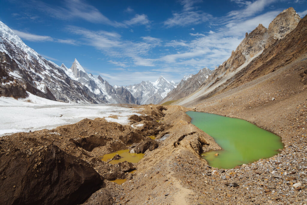
The reward is a beautiful camp beside a green meadow with wildflowers and grazing mules and horses. There’s also a gentle stream beside a stone hut canteen offering cold drinks and snacks.
Arriving at roughly 8 am, I enjoyed a cold shower and lazed in the sun for the remainder of the day.

Day 14: Kuisbang to Saitcho Camp (3,400m)
- Hike Distance: 17 km
- Duration: 5-7 hours
- Elevation: Descended 1,300 m
Following a warm rest and early night, we were all ready for the final long hike of the K2 Base Camp trek. This time, it was a scenic descent to our final camp at Saitcho (3,400 m).
The hike begins by crossing the stream at Kuisbang and following the Gondogoro Glacier, with the beautiful Laila Peak to the left along the way.


The first two hours involved familiar, rocky, and slippery underfoot until we reached the sandy trail surrounded by beautiful mountain flowers. We then followed the glacial bend south, passing Laila Peak base camp. The hike was very enjoyable and involved a gentle ever-greening descent, eventually entering a dense juniper forest before arriving at Kuisbang.


Here, we found a few stone huts, some of which were toilets and one a canteen. We spent the rest of the day enjoying the warm weather and all pitched in 3,000 rupees to buy our porters a goat as an extra (and very welcomed) tip for their hard work.

Day 15: Saitcho to Hushe and Jeep to Skardu
- Hike Distance: 11 km
- Duration: 2-3 hours
- Elevation: Descended 200 meters
The final day of trekking follows an easy, mostly flat path along the Hushe River to the green, lively town of Hushe.
The trail departed by following the river downstream, with an immediate river crossing over a wobbly bridge made from sticks and mud (which we found out collapsed a few days later causing delays).


Then, the path widened and greened as we made our way to Hushe, descending so gradually it felt completely flat. Arriving in Hushe, we exchanged high-5s, hugs, and a cold glass of Coca-Cola to celebrate an end to the epic two weeks we had just trekked in one of the most beautiful mountain regions on the planet.


Shortly after, we met our kitchen staff and porters at a local house in Hushe village where we had one final lunch and tipped them for an absolutely amazing job. Next, we hopped in the jeeps waiting outside, which drove us the whole way to Skardu, where hot showers and a real mattress awaited.


The road from Hushe to Skardu is much better than from Skardu to Askole. The only hairy sections are a few bumpy and steep cliffs at the start before getting onto sealed bitumen roads, taking roughly 3 hours to get to Skardu.

End of the Trek
The day after, we had a rest day in Skardu before our flight back to Islamabad. We took the opportunity to cafe hop, explore the town, and clean some of our dirty trekking clothes.
We arrived back in Islamabad on official "day 19" of the trip, counting our unplanned rest day in Paju Camp and out-back day hike to K2 Base Camp from Concordia. Once in Islamabad, we spent most of the time cafe hopping and eating delicious Pakistani/Afghani food at Kabul Restaurant, as well as an evening at one of the fanciest buffets I've ever eaten– the Serena Hotel.

Review: Is the K2 Trek Worth it?
Trekking to K2 Base Camp is one of the most extraordinary adventures in the world, and my experience with Epic Expeditions was overwhelmingly positive. However, this is a wild trek, and it's more suited to adventurers who want a rewarding challenge in one of the most remote regions on the planet.
The journey through the Karakoram Range, following the rugged Baltoro Glacier, was far more raw, rugged, and challenging than my many treks in Nepal. This trek is remote and the campsites on the glacier have no permanent infrastructure. This made it feel like a true "expedition-style" trek, combining epic views with a sense of real adventure that surpasses the typical teahouse trekking I'm used to.

If you're researching this trek for the views, I can confirm that this is one of the most scenic mountain regions on Earth. This is especially Concordia, the Throne Room of the Gods, by far the most scenic campsite I've ever witnessed, surrounded by views of 7,000 and 8,000-meter peaks, including K2.


In summary, the K2 Base Camp Trek with Epic Expeditions is an awesome adventure for those up for the challenge. The combination of remote, awe-inspiring landscapes, the physical demands of the trek, and the awesome team behind Epic made for an experience that I'd recommend to anyone passionate about adventure.

More Resources for the Trek to K2 Base Camp
Below are additional resources, tips, and information about the expedition-style trek to K2 BC.
- Packing List: Read my complete K2 Base Camp packing list which includes all the climbing/alpine gear required for the Gondogoro La Crossing.
- Drinking water: All water on the Boltoro comes from the glacier. Having your own filtration device is essential to avoid bacteria. I highly recommend a solid water bottle purifying filter rather for simplicity. I've been using my Grayl GeoPress for several years now, and it was perfect on the K2 Base Camp trek.
- Internet & Connectivity: Once you reach Askole, you will lose your last internet reception until Concordia, where there is a new SCOM 4G tower. However, obtaining a SIM card in Pakistan is complicated and involves a lengthy process at the telcom office. For Islamabad and Skardu, I used and recommend getting an Airalo e-Sim instead for around $7.50 for 1GB. While on the trail, I used a Garmin inReach device to message friends & family.
- Electricity & Charging: Clearly, there is no electricity on the Boltoro Glacier. However, our porters carried a generator for us to charge our cameras, drones, & electronics for roughly one hour each night.
- Drones: Unlike Nepal & India, Pakistan is very relaxed about drones. There are no permit requirements to bring in or fly a drone in Pakistan or the Karakoram Region. I was advised just to not fly over military bases, but even then a military officer watched me fly my drone with no problems.
- Mountaineering & trekking visas: To trek in the Karakoram Region, I needed to obtain a Pakistani Mountaineering & Trekking Visa. This was much more complicated than the regular tourist visa and took around 5 weeks to obtain. Luckily the Epic team arranged all the paperwork for us which was very helpful.
- The Gondogoro La: Read my guide to the Gondogoro La for more photos, videos, and information about what to expect.
- GPX, Maps, & Route: I recorded the entire trek day-by-day on my Garmin watch. You can see the entire trek route on my Strava.


Fazal Malik
Sunday 27th of April 2025
Well done, Olly! Your writing is amazing — everything is clearly and beautifully explained. I truly appreciate your work. I wish to do one more trek, a rare but very interesting and beautiful one known as the Nanga Parbat Circle Trek. I hope you will do this trek as well and write a wonderful blog about it, just like you did before.
Ibrahim Ringchan
Tuesday 17th of September 2024
Trek with you people was very amazing. I enjoyed the trek with all of you very well and your photography was very good . Thanks for the pictures ❤️❤️
M Ibrahim
Tuesday 17th of September 2024
Amazing 😍😍😍 This treak is my heart ❤️
Indri Tjandrasuwita
Wednesday 28th of August 2024
Olly, thank you so much for this well-written and detailed blog of our K2 trek experience from the beginning to end. Also Olly is an excellent photographer and I was super lucky to share this experience with him and be able to receive the benefit of his photos and blog to remember all my life.
Thank you again for sharing this beautiful blog and photos with me.
Take care Indri
Fatima
Friday 23rd of August 2024
Very well written and useful information here. I was the group that ran out of food. So trust him when he says to be more diligent with choosing the right company in Pakistan.
Thankyou for the comprehensive information and the capturing the the trek so incredibly!
Olly
Friday 23rd of August 2024
@Fatima, Thanks Fatima, next time book with Epic haha